
Tonto Forest Service Roads
Background
This project has been 30 years in the planning. Now, in theory, I have the time to get to it. During those years I have acquired a VW Baja buggy (poor man's jeep), GPS receiver, and photographic equipment. My current computer classes round out the major prerequisites necessary for the project.
Parameters
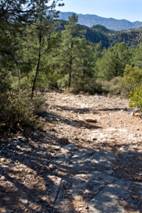
The intent is to concentrate on the northern half of Tonto National Forest in Arizona. The roads will be driven and a travelogue will be written referring to mileage on the trip. Notation will be made of streams crossed (wet or dry), the names of ridges, plus pointing out interesting items along the road. I plan on a liberal use of photographs to supplement each report. If the history of the road is known such as why it was made (mining or ranching) it will be mentioned. If the roads are passable, the report will be in this section. If the road is so neglected that it is not passable, it really is a hike and it's report will be in the hiking part of this website.
Example of report
The following is an example of such a report although this write-up is not in the final form and will be revised in the spring.
_____________________
Gowan Mike trip/hike
Nov 23, 2009
0.0 mi Set your vehicle trip odometer to 0.0 at Hwy 87 (Beeline Hwy) and Main Street in Payson. Drive west and check the mileage as you go. These readings were taken by my truck odometer and your odometer may vary. My GPS is broken and distances will be updated in the future.
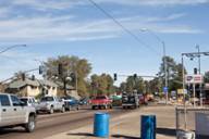
1.8 mi Pass the Payson Public Golf Course
2.4 mi Payson Sanitary District and begin a dirt road. FSR 406 also known as the Doll
Baby Road
2.5 mi Cross the American Gulch
2.9 mi Cross the American Gulch
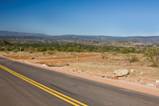
3.1 mi Start pavement
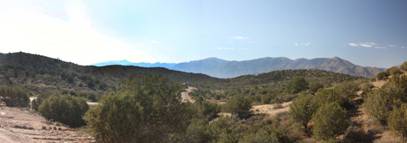
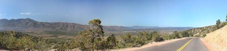
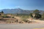
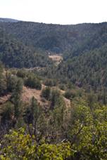
3.7 mi Crest a hill. Just beyond the crest see the Mazatzal Mtn Range.
4.4 mi FSR 510 to the left
4.6 mi Just past the crest, get another view of the Mazatzal’s and the area burned in the
2004 fire.
5.2 mi FSR 414, 193 to the left that goes to Cypress Thicket.
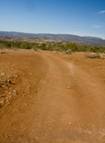
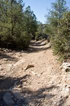
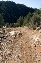
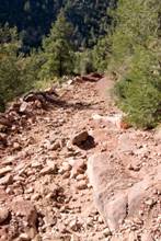
5.9 mi FSR 67 goes to the right. This is the dirt road that you want. A car should make
it but you probably don’t want it to be your car. It is safer in a 4wd truck, a quad
or an off road vehicle.
6.6 mi Cattle pens on the left
7.2 mi A Y in the road. Bear right. The left will go to a cattle pen and on through a
wire gate. I have been only as far as the pen.
7.3 mi Another Y in the road. Stay left and begin a long descent.
8.2 mi Cross the American Gulch (dry on this trip but I have been there when it was
flowing). After crossing, begin a steep climb.
9.0 mi Stock tank and trough on the right
9.5 mi FSR 643 (west end of it’s loop) goes to the left. At this intersection, there is an
unmarked road to the hard left. This unmarked one is the one you want.
I parked here not knowing what the road was like and whether there would
be a turn around area. I wasn’t even sure this was the correct road.
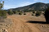
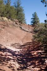
Without a GPS, I had to estimate distances. Approximately ¼ to ½ mile in, there is a place for 1 or 2 vehicles to park and turn around on the right. The road becomes more difficult beyond this point.
About 1 to 1 ½ miles in, you arrive at the East Verde River.
Turn right and the mine is 50 to 100 yards upstream and across the river. There are remains of a rock shelter with surprisingly thick walls.
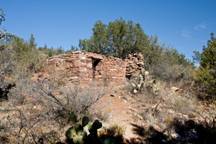
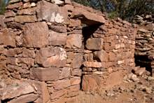
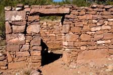
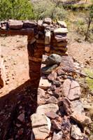
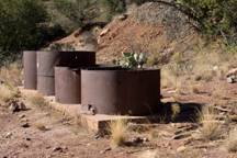
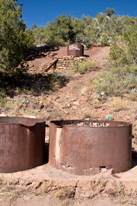
You will see the old acid tanks and remains of the stamp mill.
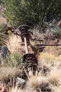
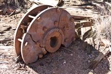
The mine shaft is to the left and up hill from the shelter as you face it from the river.
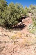
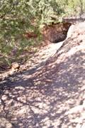
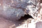
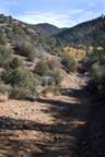
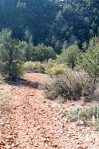
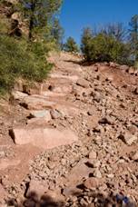
I was alone and did not enter the mine. Personally, I have no fear of caves but abandon mines do not excite me. I wish to live to hike again. I ate a small snack of trail mix and was aware of a right side abdominal pain and thought it best if I were to head back. Here are more pictures of the rough road from the hiking out view.
After hiking out to the truck, I was feeling no discomfort so I ate my packed lunch. Then the severe pain hit. I continued on road #67 as I was familiar with it and sought medical care. Five hours later, a CT scan, blood tests and a couple of pain pills resulted in no definitive diagnosis. As I write this the following day, no pain since 5 pm after the hike but the Gowan Mine trip will have its associated medical memories.
You may return the way you came or continue on as described below.
9.8 mi Junction of #67 and the east end of #643 loop that we saw at mile 9.5
10.2 mi Cross an opening in a wire fence. I have never known this gate to be closed.
11.5 mi After a long rough uphill section, cross another fence line.
12.5 mi End of #67 as it meets FSR 508. Turn left.
12.6 mi End of the dirt road as it meets paved streets of Country Club Vista, a
subdivision of Payson. In the reverse direction, there is a signage noting the
beginning of Graff Rd Trailhead FSR 508. Turn right on North Madison Drive. Turn left on West Nicklaus Drive. Turn right on North Whitehouse Drive. Turn
left on West Palmer Drive which becomes Airport Road. Continue until
meeting Hwy 87 (Beeline Hwy). Turn right to drive into Payson.